
Specificity of the Satellite approach:
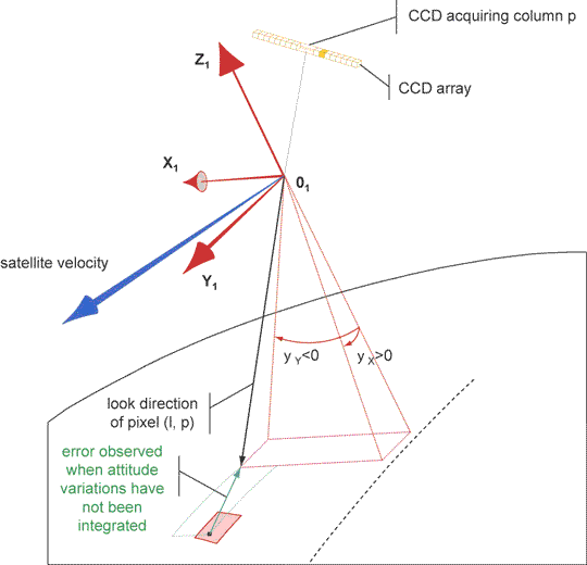
We are focusing on pushbroom satellite imaging systems: all optical parts remain fixed during the acquisition, and the scanning is accomplished by the forward motion of the spacecraft. Each line in the image is then submitted to the different variations of the platform. Precise ortho-rectification is obtained thanks to an optimized model of the imaging system where look directions are linearly corrected to compensate for attitude drifs, and sensor orientation uncertainty are accounted for. |
Specificity of the Aerial approach:
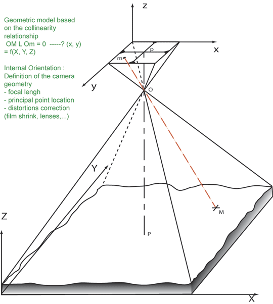
Aerial photographs, unlike pushbroom satellite images, are still images, meaning they are acquired from just one exposure, as a standard camera would do. Thus, a particular image is only affected by a stationary stereo effect, that should be compensated for. Accurate ground control points are used to this effect. |
||
2005 Kashmir Pakistan earthquake seen from ASTER images
|
1999 Hector Mine CA earthquake seen from SPOT images
|
1999 Hector Mine CA earthquake seen from Aerial images
|
1992 Landers CA earthquake seen from Aerial images
|
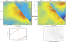
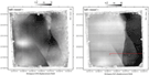
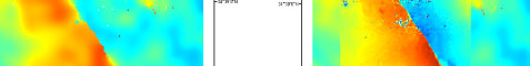
Combining satellite images and aerial images to measure ground deformation:Satellite images have a footprint (commonly 60x60km) that is generally much larger than aerial images (10x10km, at most). Unbiased GCP generation can then occur away from the deformation area in satellite images. This assumption is no longer true with aerial images and aerial GCP are then biased by the co-seismic displacement. This bias is compensated for according to the satellite measurements. We then take advantage of the generally finer resolution of aerial images (typically 10-100cm vs 1-15m) closer to the rupture, without introducing artifacts in the disparity field measured. 1999 Hector Mine CA earthquake seen from SPOT and Aerial images |
© 2004 Tectonics Observatory :: California Institute of Technology :: all rights reserved