|
< Back to Local Geology Excursions
San Gabriel Fault
Directions

Parking for San Gabriel Fault
|
- Take the 210 to Sylmar
- Take Exit 8 toward Osborne Street
- Follow signs for Osborne Street/Foothill Blvd
- Turn left on Osborne Street and head north (Note: Osborne St. becomes Little Tujunga Canyon Rd)
- After 5.4 miles, pass by the Wildlife Waystation
- After another 2.8 miles, pass over Dillon Divide
- Keep going, pass over a small bridge and by several houses
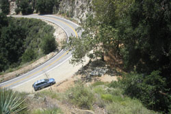
- When the road starts to climb, be on the lookout for a hairpin turn that has, on the right-hand side of the road, a wooden frame that used to hold an interpretive sign. Park here (you'll need a parking permit - see below).
Be on the lookout for poison oak!
To park anywhere within the National Forest, you need a US Forest Service Adventure Pass. They cost $5 a day and can be bought
on-line or at various vendors.
At the
site, walk on a crude trampled path back under a huge live oak tree,
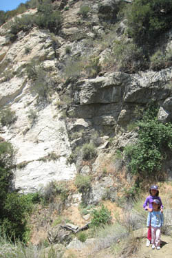
about 30 meters (100 feet), where you'll find a cliff amphitheater that has a
nice waterfall in early spring. If you stand close to the east side
(or scramble up the east hillslope a bit), you have a spectacular view of
the San Gabriel fault (vertical black line) on the vertical western cliff
face, separating light-colored "Josephine granodiorite" on the left from dark-colored "Mendenhall
gneiss" on the right.
Description

San Gabriel Fault
|
From 13 million years ago until 4 million years ago, everything south of the San Gabriel
fault slid, earthquake by earthquake, a total of about 40 km (24 miles) to the northwest. At that time, the San Andreas
fault did not exist north of the San Gabriel mountains; rather, the San
Gabriel fault was the main fault. The San Gabriel
fault is almost surely fully extinct now.
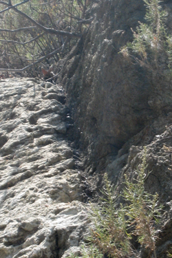
Something about the mystery of the black layer!

Close-up of San Gabriel Fault - note thin black layer in between
|
|

